







Why is Vietnam's coffee production under threat?
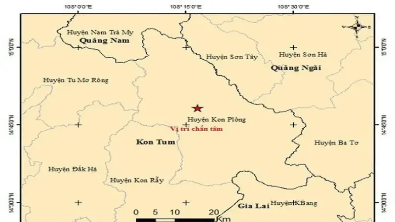
Kon Plong District in Vietnam's Kon Tum Province recorded 32 earthquakes within 24 hours, the strongest at magnitude 5.0, with shaking felt across the Central Highlands and parts of Thailand. Experts link the quakes to reservoir-induced activity and expect them to continue, putting farmland and irrigation at risk in the country's core growing zone.
Kon Tum and neighboring provinces supply roughly 70 percent of Vietnam's robusta output and sit inside the Central Highlands coffee belt. Quakes can cause farmland subsidence and lower groundwater levels, cutting irrigation water. Combined with this year's severe drought and a shrinking cultivation area, the risk to coffee production is rising.
Vietnam's core coffee-producing region, Kon Plong District in Kon Tum Province, recorded 32 earthquakes within just 24 hours, the strongest reaching magnitude 5.0, triggering tremors across the Central Highlands, surrounding provinces, and even parts of Thailand. Experts point out that these earthquakes are related to reservoir-induced activity and may continue in the future. As an important part of Vietnam's Central Highlands coffee belt, Kon Tum Province and neighboring provinces contribute about 70% of the country's robusta coffee output. The earthquakes could cause farmland subsidence, fluctuations in groundwater levels, and shortages of irrigation water. Combined with this year's severe drought and shrinking cultivation area, the risk of reduced coffee production in Vietnam is further intensifying. Front Street Coffee will continue to monitor developments in the producing region and their impact on the coffee market.
According to local Vietnamese media reports, from midnight on the 28th to the morning of the 29th, 11 earthquakes were recorded in Kon Plong District, Kon Tum Province, in south-central Vietnam. On July 28 alone, the area experienced 21 earthquakes, bringing the total to 32 within just 24 hours.
The Institute of Geophysics of Vietnam said that at around 7 a.m. on July 29, the 10th earthquake struck Kon Plong District, with a magnitude of 2.6, a focal depth of about 8.1 kilometers, and a natural disaster risk level of 0. Subsequently, the Institute of Geophysics released news of the 11th earthquake in the area. The previous day, Kon Tum Province had already been hit by 21 earthquakes.
According to records from the Institute of Geophysics, the most severe one occurred at around 11:30 a.m., with a magnitude of 5.0, classified as a level 2 natural disaster risk and the strongest earthquake ever recorded in the region. This earthquake caused widespread shaking across the Central Highlands and many central provinces, with tremors felt in distant areas such as Hue, Da Nang, and Quang Nam, and even people living in Ubon Ratchathani and Sakon Nakhon in northeastern Thailand felt the shaking.
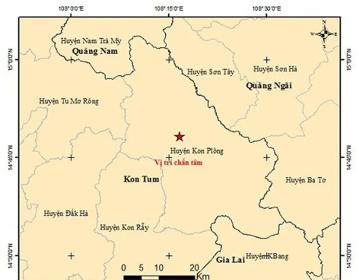
In the main epicenter area of Kon Plong District, Kon Tum Province, many houses collapsed due to the shaking, and the government has issued a level 2 natural disaster risk warning. At present, in just two days from July 28 to 29, the area experienced 32 earthquakes of varying magnitudes and focal depths. Experts believe the number of detected earthquakes has not stopped, so they are continuously tracking this seismic activity.
According to the Institute of Geophysics of Vietnam, the cause of the earthquakes is related to human activities, such as the construction of reservoirs, hydroelectric dams, mining, and nuclear explosions, and this magnitude 5 earthquake is related to reservoir-induced seismicity.
In addition, a former deputy director of the Institute of Geophysics said that Kon Tum Province will continue to experience earthquakes in the near future, but the magnitude is unlikely to exceed 5.5. Because Kon Tum Province lies on a strong fault zone, based on the geological characteristics of the earthquake area, induced earthquakes in the region may continue for many years.
It is understood that Kon Tum Province is part of Vietnam's Central Highlands coffee-producing region, which includes the provinces of Dak Lak, Lam Dong, Gia Lai, and Kon Tum, mainly cultivating the robusta variety and accounting for about 70% of the country's robusta coffee.
Earthquakes in these areas will cause farmland to sink or rise and may also trigger secondary disasters such as landslides and mudslides. In addition, earthquakes can cause fluctuations in groundwater levels and may even rupture reservoirs, which will undoubtedly further limit irrigation water for agriculture and affect coffee yield and quality.
Since the beginning of this year, Vietnam's coffee-producing regions have been affected by severe drought weather, with reports of groundwater shortages, and multiple reservoir beds drying up and cracking. The current earthquakes may worsen this situation, ultimately leading to a severe decline in Vietnam's coffee production.

Secondly, coffee has faced competition from other fruits in recent years, as growers choose to plant other crops with higher economic returns, reducing the coffee cultivation area. For this reason, industry insiders say Vietnam's coffee exports are expected to decrease by 20% year-on-year in 2024, mainly due to reduced production caused by adverse weather. However, unfavorable weather will not persist long-term; yet due to the reduction in cultivation area, it is estimated that by 2050, Vietnam could lose as much as half of its coffee cultivation area.
The above content is compiled by CoffeeHunters, a coffee news website.